
To understand hazard maps for your area, start by examining the legend and color codes, which show risk levels like floods or landslides. Look at symbols to identify specific hazards and note contour lines for elevation and danger zones influenced by climate change. Pay attention to future projections that highlight areas becoming more vulnerable. If you keep exploring, you’ll discover how to effectively interpret these maps to protect yourself and make safer decisions.
Key Takeaways
- Consult the map legend to understand symbols, colors, and contour lines representing various hazards and risk levels.
- Identify your location and nearby hazard zones to assess potential vulnerabilities in your area.
- Look for climate change projections indicating future risk zones and how hazards may evolve over time.
- Use hazard map insights to plan evacuation routes, emergency kits, and safety measures tailored to local risks.
- Regularly review updated maps to stay informed about changing hazard patterns and improve your preparedness.

Have you ever wondered how to interpret hazard maps effectively? These maps are essential tools that can help you understand the risks specific to your area, especially as climate change impacts become more pronounced. As global temperatures rise, the frequency and severity of natural disasters like floods, hurricanes, and wildfires increase, making it imperative for you to know how to read hazard maps accurately. This knowledge allows you to assess your vulnerability and incorporate this understanding into your emergency preparedness planning. Recognizing the signs and features on these maps means you can better anticipate potential hazards, prioritize safety measures, and make informed decisions about your daily routines or long-term investments.
Understanding hazard maps helps you assess risks and prepare effectively amid climate change impacts.
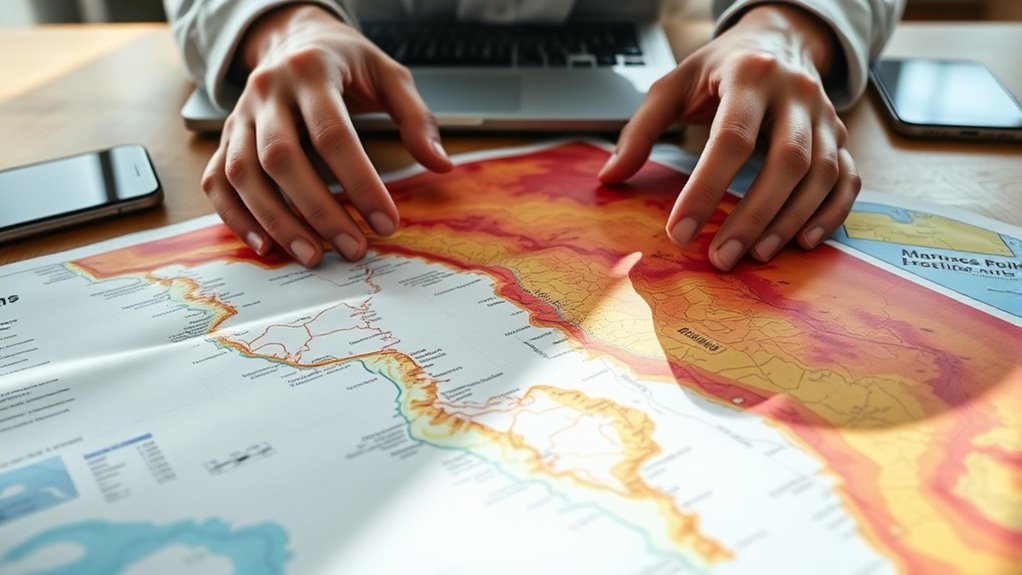
When you look at a hazard map, you’ll notice different color codes, symbols, and contours that indicate various risk levels. Understanding what these visual cues mean is essential. For example, areas shaded in red or marked with high-risk symbols are more susceptible to specific hazards, such as flooding or landslides, often influenced by climate change impacts like rising sea levels or increased storm activity. By paying attention to the map’s legend, you’ll quickly learn to interpret these symbols and assess your proximity to danger zones. This step is key in emergency preparedness planning because it helps you determine whether your home, workplace, or community is vulnerable to particular threats. Knowing this allows you to develop tailored evacuation routes, emergency kits, and communication plans.
Furthermore, hazard maps often include projections or future risk zones based on climate change scenarios. These projections are invaluable because they show how risks might evolve over time due to changing climate patterns. For instance, an area currently considered low risk could become more susceptible in the next decade as sea levels rise or weather patterns shift. By understanding these future risks, you can take proactive measures rather than reactive ones. This foresight is essential for making resilient decisions—whether that’s elevating your property, reinforcing structures, or participating in community resilience initiatives. Additionally, understanding the importance of high-resolution mapping can significantly improve your ability to interpret detailed risk information.
In essence, mastering hazard map interpretation empowers you to stay one step ahead. It’s not just about understanding where hazards exist but also about recognizing how climate change impacts are altering risk landscapes. When you incorporate this knowledge into your emergency preparedness planning, you’re better prepared to protect yourself, your loved ones, and your property. Being proactive means less panic when disaster strikes and more confidence that you’ve taken steps to minimize harm. So, take the time to learn how to read these maps thoroughly—you’re investing in your safety and resilience for the challenges ahead.

U.S. Government: a QuickStudy Laminated Reference Guide (Quick Study: Academic)
Used Book in Good Condition
As an affiliate, we earn on qualifying purchases.
As an affiliate, we earn on qualifying purchases.
Frequently Asked Questions
How Often Are Hazard Maps Updated for Accuracy?
Hazard maps are typically updated every few years to guarantee accuracy improvements, but update frequency can vary by region and hazard type. You should check with local agencies or official sources for the latest information. Regular updates help reflect new data, changes in the environment, and recent events, so staying informed about map update frequency ensures you’re using the most current hazard information and making safer decisions based on accurate maps.
Can Hazard Maps Predict Future Disaster Risks?
Hazard maps are like weather forecasts for disasters—they can hint at future risks but can’t predict with certainty. As climate change accelerates, these maps help you understand potential dangers, so you can improve your emergency preparedness. Keep in mind, they highlight areas of concern rather than exact events, so stay informed, plan ahead, and adapt your safety measures to stay resilient against evolving threats.
Are Hazard Maps Available for All Types of Natural Disasters?
Hazard maps aren’t available for all types of natural disasters, but many cover common risks like floods, earthquakes, and hurricanes. They’re essential for your disaster preparedness and emergency planning, helping you identify hazards and plan your safety measures. Keep in mind that new maps are regularly updated, so check local sources frequently. While some rare or less-studied disasters may lack maps, staying informed enhances your safety and readiness.
How Reliable Are Hazard Maps in Urban Versus Rural Areas?
You might assume hazard maps are equally reliable everywhere, but urban accuracy is generally higher due to detailed data and monitoring systems. In rural areas, coverage often lacks precision, making maps less dependable. While they provide valuable guidance, always consider local updates and expert advice, especially in rural zones where data may be limited. Trust maps as a helpful tool, but stay vigilant about their limitations in different settings.
What Should I Do if My Property Isn’t on a Hazard Map?
If your property isn’t on a hazard map, don’t worry—stay proactive. Update your property insurance to cover potential risks, even if not officially mapped. Invest in disaster preparedness measures like creating an emergency kit and developing an evacuation plan. Stay informed about local warnings and consider consulting experts for a thorough risk assessment. Being prepared guarantees you’re protected, regardless of hazard map status, giving you peace of mind during emergencies.

Survival Kit, 250Pcs Survival Gear First Aid Kit with Molle System Compatible Bag and Emergency Tent, Emergency Kit for Earthquake, Outdoor Adventure, Hiking, Hunting, Gifts for Men Women
[250 in 1 Survival Kit]: Having an emergency kit is an important step to prepare and protect your…
As an affiliate, we earn on qualifying purchases.
As an affiliate, we earn on qualifying purchases.
Conclusion
By understanding hazard maps, you hold the key to your safety, like a lighthouse guiding you through dark waters. These maps are your compass, revealing hidden dangers beneath the surface, waiting to be uncovered. When you read them carefully, you’re not just seeing lines and symbols—you’re opening a fortress of knowledge that shields you and your loved ones. Embrace this skill; it’s your first step toward turning danger into awareness and safety.

Ripeng Glow in The Dark Evacuation Route Map Holder, Acrylic Evacuation Plan Holder for Wall or Door Mount, 11.25" x 11", Adhesive Strips Included for Office Hotel School Factory
Enhanced Visibility: ensure safety with glow in the dark text on the acrylic frame, making the evacuation route…
As an affiliate, we earn on qualifying purchases.
As an affiliate, we earn on qualifying purchases.

Climate Change Risk Profile of the Mountain Region in Sri Lanka
As an affiliate, we earn on qualifying purchases.
As an affiliate, we earn on qualifying purchases.