After recent tremors at Mount St. Helens, monitoring efforts have ramped up considerably. You’ll find an extensive network of seismic stations providing real-time data to predict potential eruptions. GPS and Lidar technology track ground deformation, giving essential warnings. Gas emissions are closely observed for any changes that could indicate unrest. Visual and acoustic monitoring adds detail to the ongoing assessment. If you want to explore more about these monitoring strategies, there’s plenty more to uncover.
Key Takeaways
- Increased seismic activity at Mount St. Helens has prompted heightened monitoring efforts to assess eruption risk.
- An extensive network of seismic stations provides real-time data crucial for predicting potential eruptions.
- Permanent GPS stations track ground deformation, offering warnings for signs of volcanic unrest.
- Gas emissions monitoring stations detect changes in volcanic gases, aiding in understanding the volcano’s state.
- Visual and acoustic monitoring enhance awareness by documenting real-time volcanic activity and emissions.
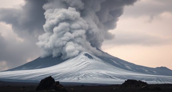
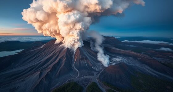
Since its formation over 275,000 years ago, Mount St. Helens has been an active volcano, fascinating scientists and the public alike. With its four eruptive stages, it holds the title of the most studied volcano globally, providing invaluable insights into volcanic activity and ecological recovery. After recent tremors, monitoring efforts have ramped up considerably, utilizing advanced technologies to guarantee safety and enhance eruption forecasting.
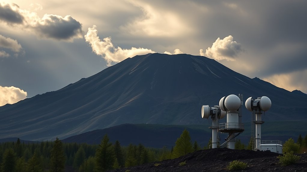
You might be surprised to learn that Mount St. Helens is equipped with an extensive network of seismic monitoring stations. These stations continuously collect data, allowing scientists to analyze seismic activity in real-time. When tremors occur, these systems play an essential role in predicting potential eruptions. By examining the patterns of seismic changes, researchers can assess whether an eruption is imminent, which is crucial for public safety.
In addition to seismic monitoring, the volcano benefits from cutting-edge geodetic systems. Permanent GPS stations track ground deformation, providing important warnings if the volcano shows signs of unrest. Lidar technology offers detailed topographical data, helping scientists understand how the landscape is evolving. This combination of tools means that when tremors shake the ground, you can trust that experts are closely watching for any notable changes that might indicate a brewing eruption.
Gas emissions also give researchers important clues about volcanic activity. With dedicated gas monitoring stations, scientists can observe changes in emissions, which sometimes increase without any seismic activity. This aspect of monitoring helps you appreciate how dynamic and complex volcanic systems can be. By analyzing gas data, experts gain a clearer understanding of the volcano’s current state, which is essential for accurate forecasting.
Visual and acoustic monitoring further enhances the understanding of Mount St. Helens. Remote cameras provide real-time visuals of the volcano, documenting any ash clouds or lava flows. Acoustic monitoring captures sounds from volcanic processes, adding another layer of detail to the ongoing analysis. Together, these methods create a thorough monitoring approach that guarantees you stay informed about the volcano’s behavior.
As collaboration between the Mount St. Helens Science and Learning Center and the U.S. Forest Service continues, you can feel reassured that efforts to monitor this iconic volcano will only grow stronger. The increased focus on monitoring after tremors is critical in safeguarding the surrounding communities and enriching our understanding of volcanic activity.
Frequently Asked Questions
What Types of Tremors Are Being Monitored at Mount St. Helens?
At Mount St. Helens, you’ll find several types of tremors being monitored.
Discrete earthquakes, with their sharp jolts, contrast with continuous ground vibrations that signal subsurface fluid movement.
Harmonic tremors indicate rhythmic shaking linked to magma.
Each tremor type varies in duration and intensity, vital for evaluating volcanic hazards.
Seismographs capture these events, providing important data that helps predict potential eruptions and informs safety measures for nearby communities.
How Does the Monitoring Equipment Work at the Volcano?
Monitoring equipment at volcanoes works through various advanced technologies. Seismic sensors detect ground motion, while GPS stations track changes in shape.
Lidar creates detailed 3D terrain models, and tiltmeters measure ground tilt indicating magma movement. Gas sampling monitors emissions, providing insights into activity.
Real-time data transmission guarantees immediate analysis, complemented by remote cameras and hydrological stations that track water levels.
This combination helps you assess volcanic hazards effectively and enhance safety measures.
Who Is Responsible for Monitoring Mount St. Helens?
When it comes to monitoring Mount St. Helens, you’ve got a team of dedicated organizations on your side.
The Pacific Northwest Seismic Network and the U.S. Geological Survey lead the charge, keeping a close eye on seismic activity.
The Cascades Volcano Observatory specializes in volcanic monitoring, while local and federal agencies collaborate for effective response.
With these experts in your corner, you can rest assured that Mount St. Helens is under vigilant watch.
What Should Residents Do During a Volcanic Eruption Warning?
During a volcanic eruption warning, you should stay informed by monitoring local news and NOAA updates.
Establish your family evacuation plan and gather emergency supplies like food and first aid kits.
If you need to shelter in place, move to an interior room, close windows and doors, and shut off HVAC systems to keep ash out.
Keep your pets safe and make certain they’ve enough food and water during the emergency.
Are There Any Signs of an Imminent Eruption at Mount St. Helens?
A serene landscape can quickly transform into chaos, reminding you that nature’s beauty often hides its fury.
Right now, signs of an imminent eruption at Mount St. Helens are hard to pinpoint definitively. However, if you notice increased seismic activity, particularly shallow earthquakes, or shifts in volcanic gases, it’s wise to stay alert.
Monitoring efforts provide essential data, so keep an eye on updates from local agencies to stay informed and prepared.
Conclusion
As you keep an eye on Mount St. Helens, remember that nature can be as unpredictable as a surprise party. With the recent tremors, monitoring efforts are ramping up to guarantee everyone’s safety and stay ahead of any potential eruptions. Staying informed and prepared is key, so don’t let your guard down. Keep watching the volcano’s activity, and who knows? You might just witness the earth’s raw power in action—it’s a show you won’t want to miss!