
To navigate without technology, you rely on precise map reading, understanding symbols and terrain features, and using a compass for orientation. Recognize natural landmarks like rivers, distinctive trees, and rock formations, then use triangulation to pinpoint your location. Always plan your route carefully, considering terrain and safety. Continuously verify your position with natural cues, and remember that mastering these skills makes wilderness navigation confident and reliable—if you keep exploring, you’ll uncover even more effective techniques.
Key Takeaways
- Master map symbols, terrain features, and natural landmarks to interpret and relate map data to real-world surroundings.
- Properly use and calibrate a compass, aligning it with landscape features and adjusting for magnetic declination.
- Identify and triangulate landmarks by estimating distances and angles to determine precise location on the map.
- Rely on natural cues such as terrain textures, water features, and wildlife signs to confirm position and guide navigation.
- Plan routes strategically, consider environmental conditions, and regularly reassess position to ensure safe, effective navigation without technology.

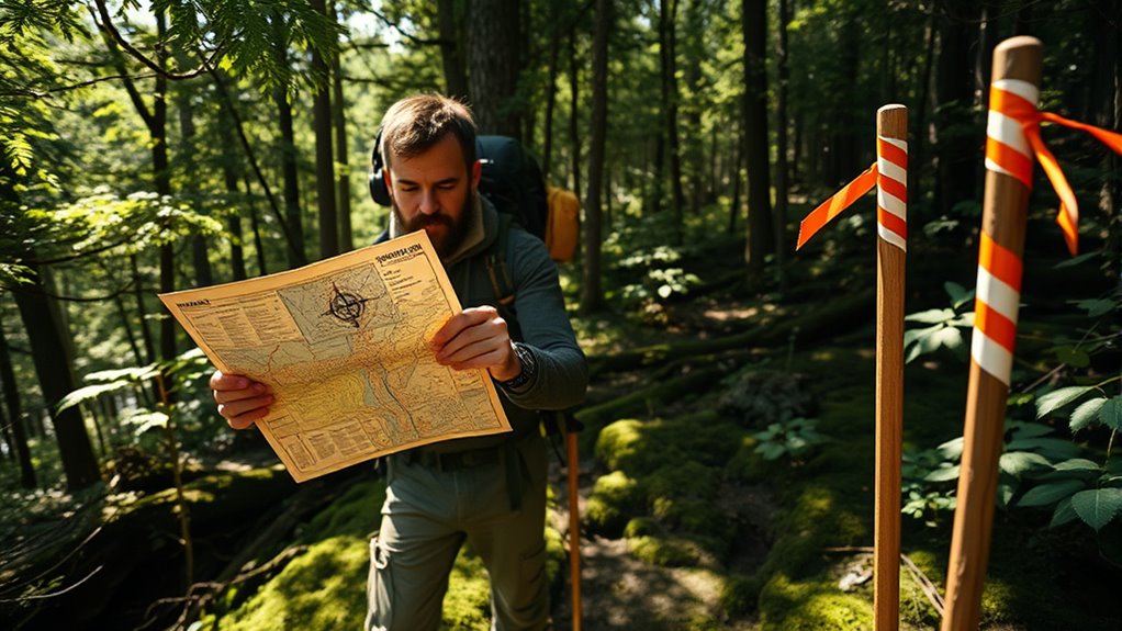
Topographic Map Symbols
USGS Topographic Maps
As an affiliate, we earn on qualifying purchases.
As an affiliate, we earn on qualifying purchases.
Understanding Map Symbols and Topography

To navigate effectively in orienteering, you need to understand the symbols and topographical features on your map. The map legend explains the various symbols that represent terrain features like streams, cliffs, or vegetation types. Recognizing these symbols helps you identify key landmarks and obstacles in your route. Topographical features, such as contour lines, show elevation changes and landforms like hills or valleys, giving you a sense of the terrain’s shape. By mastering how to interpret the map legend and terrain features, you can make informed decisions about your path, avoid hazards, and stay oriented. Understanding water features such as lakes and streams can be particularly helpful in certain terrains. This foundational knowledge allows you to translate the two-dimensional map into real-world terrain, keeping you confident and accurate as you navigate through the course.

4 Pcs Outdoor Compass with Adjustable Declination,Magnifier,Ruler,Scale. Multifunctional Orienteering Waterproof Compass for Map Reading, Navigation, Hiking (Transparent+Blue+Green+Orange)
Accurate Readings: This outdoor compass features a rotating bezel and precise needle for reliable directional guidance.
As an affiliate, we earn on qualifying purchases.
As an affiliate, we earn on qualifying purchases.
Mastering Compass Use and Orientation
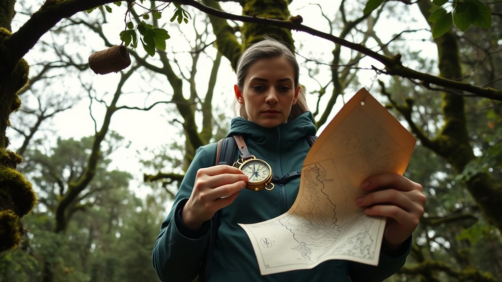
Learning to read compass directions helps you navigate accurately through any terrain. By aligning your map with the landscape, you guarantee your route stays on track. Mastering these skills makes orienteering more precise and confident. Incorporating traditional navigation tools like a compass enhances your outdoor preparedness and self-reliance. A clear understanding of contrast ratio also improves your ability to interpret terrain features and landmarks effectively. Additionally, understanding how to use natural navigation cues can be invaluable when technology fails or is unavailable. Developing a data-driven strategy in your navigation approach can help you adapt to various conditions and challenges. Engaging in mindful decluttering of your navigation gear ensures you carry only what is necessary and organized for quick access when needed.
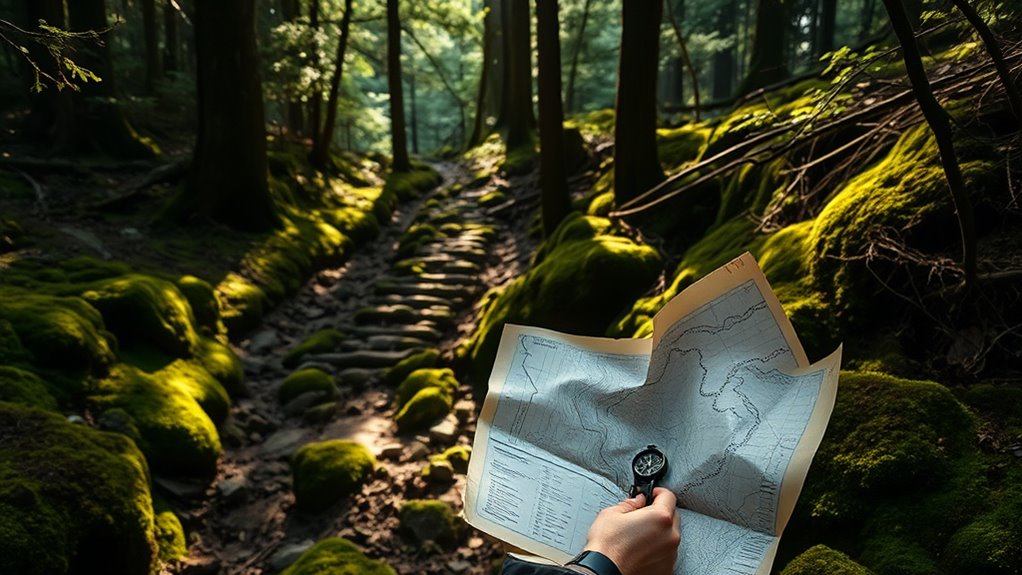
Reading Compass Directions
Understanding how to read compass directions is essential for accurately orienting through unfamiliar terrain. You need to account for magnetic declination, which varies by location, to guarantee your readings are precise. Always calibrate your compass before use to correct for any magnetism interference. To read directions, hold your compass flat, align the needle with the orienting arrow, and read the bearing at the bezel’s index line. Use the table below to interpret your bearings:
| Degree Range | Direction | Notes |
|---|---|---|
| 0° – 22.5° | North | Slight variation |
| 22.5° – 67.5° | NE | Northeast |
| 67.5° – 112.5° | East | Directly east |
| 112.5° – 157.5° | SE | Southeast |
| 157.5° – 202.5° | South | Directly south |
Mastering these steps guarantees accurate navigation without tech. Proper data processing speeds can enhance your ability to interpret compass readings quickly and accurately, especially in challenging environments. Additionally, understanding how to incorporate magnetic declination adjustments into your readings is crucial for precise navigation. Developing a solid understanding of compass calibration techniques ensures your readings remain reliable even in complex terrains. Regularly practicing these skills helps build confidence and navigational accuracy in real-world situations.
Aligning Map and Terrain
Aligning your map with the terrain is a crucial step in accurate navigation. Start by orienting your map to match the terrain’s features, using landmarks like hills, rivers, or distinctive trees. To do this effectively, consider the map’s scale—understanding map scaling helps you judge distances correctly. Once your map’s direction aligns with your surroundings, perform terrain matching by confirming features on the map correspond with what you see in the terrain. Look for consistent landmarks or contours, and adjust your map if needed. Precise alignment ensures your navigation stays on track, reducing the risk of wandering off course. Regularly verify your position by comparing the map and terrain features, keeping your bearings clear and your route accurate. Knowing the resale value of your equipment can also help you plan for potential future expenses or upgrades. Additionally, being familiar with family dynamics and how they influence your decision-making can improve your ability to adapt in uncertain situations. Incorporating air quality awareness into your navigation practices can also be beneficial, especially in areas prone to pollution or poor air conditions.

The Sibley Guide to Birds, 2nd Edition
Sibley Guide To Birds, 2nd Ed
As an affiliate, we earn on qualifying purchases.
As an affiliate, we earn on qualifying purchases.
Planning Your Route and Navigational Strategy
How you plan your route can make all the difference between a smooth navigation and a frustrating detour. Effective route planning involves evaluating the terrain, considering your skill level, and setting realistic goals. Start by examining your map thoroughly, noting key features and potential obstacles. Strategy development is essential; decide on the most efficient path to reach your waypoints while avoiding hazards. Break the route into manageable segments, and think about alternate options in case conditions change. Prioritize safety and efficiency, rather than shortest distance alone. Additionally, understanding your environmental considerations and your electric bike’s capabilities can help tailor your route for optimal performance and battery life. Being aware of pimple patch effectiveness and placement can serve as a metaphor for careful planning in navigation, ensuring you’re prepared for unexpected challenges. Recognizing the importance of tuning options from vehicle modifications can inspire you to adapt your strategy based on real-time feedback and conditions. Incorporating topographical features into your planning can further improve your navigation accuracy. By carefully planning your route and developing a solid strategy beforehand, you’ll navigate with confidence, minimize surprises, and stay on track throughout your journey.

Wilderness Navigation: Finding Your Way Using Map, Compass, Altimeter & GPS
As an affiliate, we earn on qualifying purchases.
As an affiliate, we earn on qualifying purchases.
Using Landmarks and Natural Features for Guidance

You can stay on track by recognizing distinct landmarks like unique trees or rock formations. Natural terrain features such as ridges, streams, and valleys also help confirm your position. Using these cues consistently keeps your navigation accurate and confident. Additionally, understanding landmark identification can serve as an analogy for maintaining your sense of orientation, ensuring you don’t over-rely on any single landmark. Developing a growth mindset toward navigation challenges can enhance your ability to adapt when familiar landmarks are obscured or unavailable. Emphasizing the importance of fathers’ guidance can inspire confidence in your navigation skills, much like a father’s support guides a child’s growth. Recognizing the names of dog breeds in your surroundings can also sharpen your observational skills and deepen your understanding of natural cues.
Recognizing Distinct Landmarks
Recognizing distinct landmarks is essential for effective navigation in orienteering. You rely on visual landmarks that stand out in the landscape, like large trees, unique rock formations, or water bodies. Man-made structures, such as fences, bridges, or buildings, also serve as reliable reference points. To succeed, focus on identifying features that are easily distinguishable and unlikely to change over time. Take time to study the landscape and memorize key landmarks along your route. When you reach a landmark, confirm its details before moving on, ensuring you’re on the right path. Remember, clear visual cues help you maintain your bearings, especially in unfamiliar terrain. By honing your ability to recognize and remember landmarks, you’ll navigate more confidently without relying on technology. Additionally, understanding the retail hours of nearby facilities can be useful for planning breaks or emergencies during your outdoor activity. Recognizing natural features such as terrain types and water sources can further enhance your navigation skills, making your outdoor experience safer and more enjoyable.
Using Natural Terrain Features
Natural terrain features are invaluable tools for navigation because they provide consistent, easily identifiable cues in the landscape. By observing terrain textures like rocky outcroppings or dense forest patches, you can determine your position more accurately. Wildlife signs, such as tracks or nests, also indicate proximity to specific features or water sources. To effectively use natural terrain features, consider these points:
- Identify distinctive terrain textures that stand out from surrounding areas.
- Recognize wildlife signs that suggest nearby water or shelter.
- Use natural features like ridges, valleys, and watercourses as guiding landmarks.
- Observe changes in terrain textures to confirm your movement and location.
These cues help you navigate confidently without relying on technology, enhancing your awareness of the natural landscape.
Employing Triangulation to Determine Your Position

Have you ever wondered how orienteers pinpoint their exact location in unfamiliar terrain? One key skill is visual triangulation, which involves identifying two or more known landmarks. You start by choosing prominent features that are visible from your position, like a hilltop or distinctive tree. Then, estimate the distance to each landmark using natural cues or known measurements, a skill called distance estimation. By observing the angles between these landmarks and your position, you can create a mental or physical triangle. When you combine this with your estimates of distance, you can accurately determine your location on the map. This technique doesn’t rely on technology, but on your ability to interpret natural features and your environment precisely.
Safety Tips and Best Practices for Wilderness Navigation

Ensuring safety while exploring in the wilderness is essential to prevent getting lost or encountering danger. Proper emergency preparedness and gear selection are key. Always carry a map, compass, and a first aid kit. Before heading out, plan your route and share your itinerary with someone reliable.
Consider these best practices:
- Check weather conditions and adjust plans accordingly.
- Carry sufficient water, food, and emergency supplies.
- Stay aware of landmarks to avoid disorientation.
- Regularly re-assess your position using traditional navigation skills.
Frequently Asked Questions
How Can I Navigate Effectively Without Any Tools?
To navigate effectively without tools, you rely on your observation skills. Use map reading to understand your surroundings and plan your route. Look for natural signs like rivers, mountains, and tree patterns to orient yourself. Keep track of landmarks, and always check your direction with the sun’s position or shadows. Practice these skills regularly, so you can confidently find your way even without technology.
What Are Common Mistakes Beginners Make in Orienteering?
You might think beginners never make mistakes in orienteering, but that’s not true. Common errors include misreading the map, which leads you off course, and poor compass skills, causing directional confusion. Always double-check your map reading and practice your compass skills regularly. Don’t rush; taking your time guarantees accuracy. Remember, even experienced navigators make mistakes, so stay patient and stay aware of your surroundings to improve your skills.
How Do Weather Conditions Affect Traditional Navigation Techniques?
Weather conditions like cloud cover and wind patterns greatly impact your navigation. Cloud cover can obscure the sun and stars, making it harder to determine your direction with a compass or natural cues. Wind patterns can shift your scent trail or disturb your landmarks. You need to stay alert, adapt your techniques, and use your surroundings creatively to stay on course when weather isn’t cooperating.
Can Animals or Plants Help in Navigation?
Absolutely, animals and plants can assist in navigation. Animal tracking reveals subtle signs like footprints or disturbed foliage, guiding you toward water or shelter. Plant indicators, such as moss on north-facing trees or certain flowering patterns, hint at directions or nearby resources. By observing these natural clues, you can enhance your orientation skills, understanding that nature’s signals often subtly suggest safe paths or promising destinations.
What Skills Are Essential for Emergency Survival Without Technology?
In an emergency without technology, you need essential skills like map reading and natural sign interpretation. By understanding how to read a map, you can determine your location and plan your route. Recognizing natural signs, such as animal tracks or plant growth, helps you find water, shelter, or safe paths. These skills keep you oriented and boost your chances of survival until help arrives.
Conclusion
So, after all that, you might think modern tech makes navigation foolproof. But isn’t it ironic that relying solely on gadgets can leave you lost when batteries die or signals fade? Mastering traditional skills keeps you grounded—literally—without screens or signals. Next time you venture into the wilderness, remember: the most reliable tool isn’t your phone, but your brain and basic skills. After all, nature’s surprises are best navigated with a little old-fashioned know-how.