Drones are essential tools for damage assessment and rescue, helping you quickly survey large disaster zones with high-resolution aerial images. They provide detailed maps and identify collapsed structures, blocked roads, and potential survivors, speeding up response efforts. Using drones improves accuracy, saves time, and enhances situational awareness. But, to operate them effectively, you need to understand the regulations and restrictions in your area. If you keep exploring, you’ll discover how to navigate these rules safely and effectively.
Key Takeaways
- Drones enable rapid, high-resolution aerial surveys to assess damage and identify safe rescue routes in disaster zones.
- They create real-time maps highlighting collapsed structures and blocked roads, aiding rescue planning.
- Drones improve accuracy and speed of damage evaluation, saving critical response time during emergencies.
- Regulatory compliance is essential to ensure safe, legal drone operations in disaster scenarios.
- Understanding local drone laws and obtaining necessary permits help prevent operational delays and legal issues.
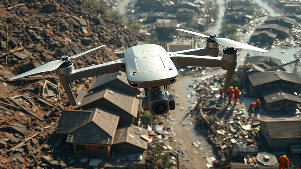
Drones have become an essential tool in damage assessment and rescue operations, offering rapid and accurate insights in disaster-stricken areas. When deployed, they can quickly survey large regions, providing critical information that helps rescue teams make informed decisions. One of the key features enabling this efficiency is aerial mapping. By capturing high-resolution images from above, drones create detailed maps that highlight affected zones, collapsed structures, and blocked roads. This real-time imagery allows responders to prioritize their efforts, identify survivors, and plan safe routes through hazardous environments. With aerial mapping, you can visualize the scope of destruction more precisely than traditional methods, saving valuable time during critical rescue moments.
However, using drones for damage assessment isn’t without its challenges. You need to be aware of drone regulations that govern their operation in different jurisdictions. These rules are established to guarantee safety, privacy, and airspace management. Before launching your drone, check whether you require permits or certifications, especially in urban or restricted areas. Many countries have specific altitude limits, no-fly zones, and operational guidelines that you must adhere to. Ignoring these regulations can lead to legal trouble or safety hazards, which is why understanding local drone laws is essential. By staying compliant, you ensure that your drone missions are conducted smoothly and ethically, avoiding potential delays or penalties. Additionally, understanding the regulatory environment helps you plan your missions more effectively and prevent operational disruptions.
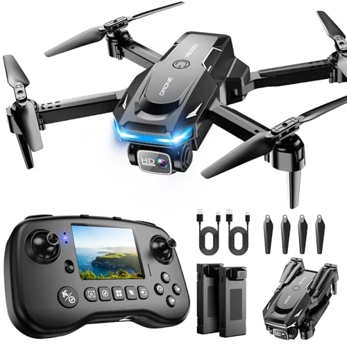
Drone with Camera – Drone with Screen on Controller for Beginners, Foldable Remote Control Quadcopter with Gesture Control, 3D Flip, One Key Start, Emergency Stop, 2 Batteries, Easier to use
The PK01 drone's remote comes with a super handy built-in screen—no phone needed—so you can watch live HD…
As an affiliate, we earn on qualifying purchases.
As an affiliate, we earn on qualifying purchases.
Frequently Asked Questions
What Are the Legal Restrictions for Drone Use in Disaster Zones?
You need to follow airspace regulations and respect privacy concerns when using drones in disaster zones. Many areas restrict drone flights over certain zones or require special permits, especially in emergency situations. You should obtain necessary permissions from authorities and avoid capturing private property or individuals without consent. Staying compliant helps ensure your drone operation supports rescue efforts without causing legal issues or infringing on privacy rights.
How Do Drones Perform in Extreme Weather Conditions?
You’ll find that drones’ weather resilience varies based on their design and specifications. In extreme weather conditions like heavy rain, strong winds, or snow, their operational limitations become evident, potentially affecting flight stability and data accuracy. To guarantee safety and effectiveness, always check your drone’s weather resilience and avoid flying in severe conditions. Proper planning helps you maximize performance and minimizes risks during critical missions.
What Is the Cost of Deploying Drones for Rescue Missions?
The cost of deploying drones for rescue missions varies depending on the type and complexity of the operation. You should consider the cost analysis of drone equipment, maintenance, and pilot training when planning your budget. Deployment expenses include transportation, setup, and operational costs during emergencies. While initial investments can be high, the efficiency and safety benefits often justify the expenses, especially in hard-to-reach or hazardous areas.
How Is Data Security Maintained During Drone Operations?
Oh, of course, data security is a breeze — just like locking a door with a paperclip. You implement robust encryption protocols to keep data private, ensuring that only authorized personnel access sensitive info. You also prioritize data privacy, preventing any unauthorized sharing or breaches during drone operations. With these simple measures, you can confidently fly your drones, knowing your data remains secure and private, even in the chaos of rescue missions.
Can Drones Operate Autonomously Without Human Control?
Yes, drones can operate autonomously using advanced systems like autonomous navigation and obstacle detection. You’ll find that they can independently follow pre-programmed routes and avoid obstacles in real-time, reducing the need for manual control. This capability allows drones to efficiently perform tasks such as damage assessment or rescue operations, especially in hazardous or hard-to-reach areas. However, human oversight remains vital to guarantee safety and proper operation.

UAS Pilot Log Expanded Edition: Unmanned Aircraft Systems Logbook for Drone Pilots & Operators
As an affiliate, we earn on qualifying purchases.
As an affiliate, we earn on qualifying purchases.
Conclusion
Drones revolutionize damage assessment and rescue efforts, enabling faster response times and safer operations. With over 85% of emergency responders now incorporating drones into their workflows, their importance keeps growing. By providing real-time visuals and reaching inaccessible areas, you can save lives and minimize damage more effectively. Embracing this technology not only enhances your rescue capabilities but also makes your efforts more precise and efficient, ultimately saving more lives when every second counts.

Autel Robotics EVO II Dual 640T V3, 640×512 Thermal Imaging Drone, Remote ID Supported, 0.8'' CMOS&50MP 8K RYYB Sensor,10+ Temp Measurement, D-RI Ranges, Thermal Analysis Tool, for Search&Rescue/Power Inspection/Public Safety/Hunting
🏆【AUTEL ROBOTICS USA AUTHORIZED】We are the longest and largest distributors of Autel Robotics. Over the years, we have…
As an affiliate, we earn on qualifying purchases.
As an affiliate, we earn on qualifying purchases.

A GUIDEBOOK APPLYING FOR A UNMANNED AERIAL SYSTEM (UAS)/DRONE PERMIT IN MALAYSIA: VERSION: 0.1 (MAY 2024)
As an affiliate, we earn on qualifying purchases.
As an affiliate, we earn on qualifying purchases.